
Aysén in depth · Part 11 ·
The Ring of Fire in Aysén:
volcanoes, a fault, and a wave that reached fifty metres
Jaroslav Sokol · Aysén region, Chile · 12 min read
Read by a synthetic voice.
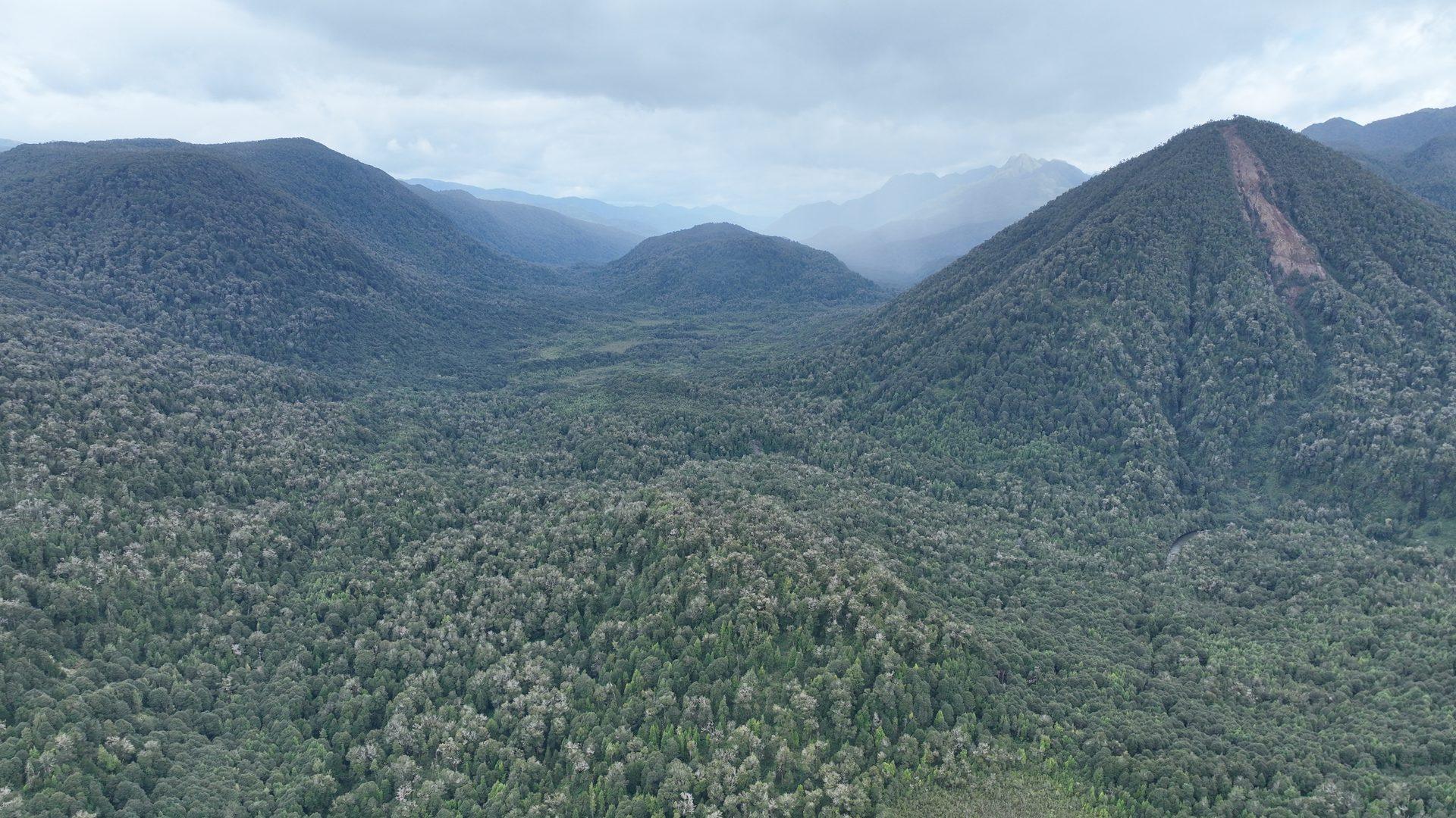
The short answer
The Aysén region sits on the Ring of Fire: the Nazca plate is subducting beneath South America here at roughly 71 millimetres a year. The region has five monitored volcanoes, Hudson (1,905 m), Macá (2,960 m), Cay (2,090 m), Mentolat (1,603 m) and Melimoyu (2,400 m), and the Aysén fjord itself is carved along the Liquiñe-Ofqui fault, which runs for 1,000 to 1,200 kilometres. In 1991 Hudson erupted around 4 km³ of tephra and buried more than 100,000 km². In April 2007 an earthquake of Mw 6.2 in the fjord triggered 538 landslides, and one of them raised a wave with a run-up of up to 50 metres at Isla Mentirosa that killed ten people.
Why there are volcanoes here
The oceanic Nazca plate is subducting along the entire western edge of South America. According to the United States Geological Survey it moves east at roughly 71 millimetres a year and disappears under the continent in the Peru-Chile trench. Water carried down with the plate lowers the melting point of the mantle, magma forms, and a chain of volcanoes runs above the subduction zone.
Peer-reviewed sources credit Chile with 92 active volcanoes, meaning volcanoes with documented or probable activity in the Holocene. For 35 of them activity is documented from the 16th century onwards, and more than four hundred volcanic events are on the historical record. The Smithsonian database lists 90 Holocene volcanoes for Chile.
Czech and Chilean sources often write that Chile is "the country with the second highest number of active volcanoes in the world". The Smithsonian's own counts do not support that: the United States has 165 Holocene volcanoes, Indonesia 101 and Chile 90. The ranking only holds under one particular definition, so it is more honest to write that Chile has one of the largest concentrations of active volcanoes in the world.
Aysén has a tectonic peculiarity you will not find anywhere else in Chile
At roughly 46°12′ south, off the Taitao and Tres Montes peninsulas, three plates meet at once: the South American, the Nazca and the Antarctic. This is the Chile triple junction.
The Antarctic plate began to subduct here about fourteen million years ago, and the triple junction has been travelling north ever since, having started at the latitude of Tierra del Fuego.
In practice this means that Aysén is the only place on the Chilean coast where an active oceanic ridge is being fed into the trench. It is not simply "volcanic Chile", it is a seam where the recipe changes.
The volcanoes of the Aysén region
Cerro Hudson, 1,905 m. The southernmost volcano of the Chilean Andes proper. It has an ice-filled caldera ten kilometres across covering around 300 km², and that caldera was not recognised at all until the first eruption of the 20th century, in 1971. The last eruption was in 2011. In a straight line the volcano is about 59 km from Puerto Aysén and roughly 79 km from Coyhaique.
Macá, 2,960 m. The highest mountain in the region, a glaciated stratovolcano with a lava dome inside its caldera. A fissure fifteen kilometres long runs from the summit down to Bahía Pérez and carries five flank cones. The last eruption was in 1560, although the lava flow from one of the cones near Bahía Pérez was emplaced between 1450 and 1670.
Cay, 2,090 m. About half a dozen explosive craters and ten basaltic cones on fissures that follow the Liquiñe-Ofqui fault. More recent analysis found no evidence for the Holocene eruptions that used to be assumed.
Mentolat, 1,603 m. It stands on Magdalena Island and has an ice-filled caldera six kilometres across. The last eruption was in 1710.
Melimoyu, 2,400 m. An eight kilometre wide caldera, largely buried and lying under ice. The last eruption was around AD 200, and in 2010 the alert level was raised because of increased seismicity.
Puyuhuapi, 524 m. Not a single peak but a field of basaltic scoria cones on two fissures right at the head of the Puyuhuapi fjord, with lava flows that reached the sea. The Smithsonian describes them as exceptionally well preserved, which points to a very young age. They lie beside the road and beside the hot springs.
Hudson 1991: the eruption after which people stopped farming
The eruption began on 8 August 1991 at 18:20 local time, after only three to four hours of precursory seismicity. The main phase ran from 12 to 15 August, when the column reached roughly 18 kilometres above sea level, and the activity ended on 27 October.
The eruption rated VEI 5. Sources differ on the volume of tephra: the most recent peer-reviewed work uses 4.35 km³, while estimates made in 1991 gave a range of 2 to 6 km³. The honest figure is therefore "about 4 km³".
Ash covered more than 100,000 km² of Chile and Argentina. Ten kilometres from the crater the deposits were over two and a half metres thick, and the ten centimetre isoline reached southeast of Chile Chico, 120 km from the volcano. One to two centimetres fell on the Argentine Atlantic coast, and ash travelled as far as a thousand kilometres, to the Falkland Islands.
Sulphur could be smelled 150 kilometres away in Cochrane and 75 kilometres away in Coyhaique; acid rain was reported from a distance of 360 kilometres. Satellite measurements put 1.5 megatonnes of sulphur dioxide in the cloud.
Livestock losses differ between sources: a peer-reviewed paper in the journal Natural Hazards speaks of around a million animals dead, another source of 500,000 to 600,000 sheep. A survey made at the time found that within thirty days of the end of the eruption 50% of the sheep and cattle in the affected area had died. What is interesting is what was not the cause: the fluorine content of the ash was far below the toxic threshold, and the myth of fluorine poisoning has been refuted.
The most lasting consequence is in the landscape. A study from 2011 documents long term abandonment of farms after the eruption, both in the upper Ibáñez valley in Chile and on the Argentine steppe. Diversified horticultural farms recovered; monoculture sheep operations did not.
One more figure for scale: the Hudson eruption of roughly 3,600 years ago threw out more than 10 km³ of tephra, which is over twice the volume of 1991, and the eruption 6,700 years ago is among the largest known in the whole of the southern Andes. 1991 was the smaller of them.
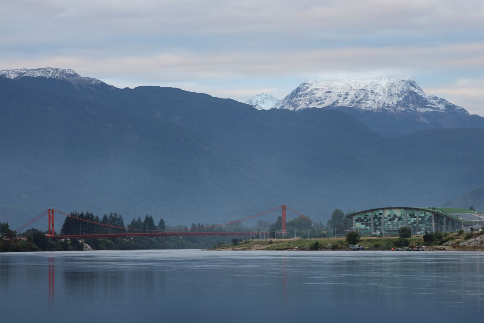
The fault that carved the fjord and then buried it
The Liquiñe-Ofqui fault is a dextral strike-slip fault running north-northeast across the North Patagonian Andes. Sources disagree about its length: both 1,000 and 1,200 kilometres are quoted.
The fault absorbs the trench-parallel component of the motion of the Nazca plate, and has been doing so since the middle Miocene. Most of the large stratovolcanoes of the southern volcanic zone are aligned along it, because it is the plumbing through which magma rises.
The Aysén fjord is carved directly along this fault. At the fjord the fault consists of two overlapping master faults linked by a series of dextral faults arranged en echelon.
Measurements on one branch of the fault about 700 kilometres further north gave a slip rate of 18.8 ± 2.0 mm per year over the last nine thousand years. The authors note that this is comparable with the creeping sections of the San Andreas fault and the North Anatolian fault.
April 2007: 538 landslides and a wave
The earthquake swarm in the Aysén fjord began on 22 January 2007 and peaked on 21 April 2007. It was a swarm driven by fluids inside the Liquiñe-Ofqui fault.
The main shock had a magnitude of Mw 6.2, with the epicentre inside the fjord at 45.3° S and 73.0° W, at a depth of less than nine kilometres. Shaking reached intensity VIII to IX on the Mercalli scale near the epicentre and VII in Puerto Chacabuco and Puerto Aysén.
The shock triggered 538 landslides. Their distribution follows the branches of the fault, because that is where the rock has been shattered by millions of years of grinding. The Punta Cola rockslide had an initial volume of about 20.9 million m³ and entrained a further 7.3 million m³ on its way down, while the slide on Isla Mentirosa amounted to eight million m³.
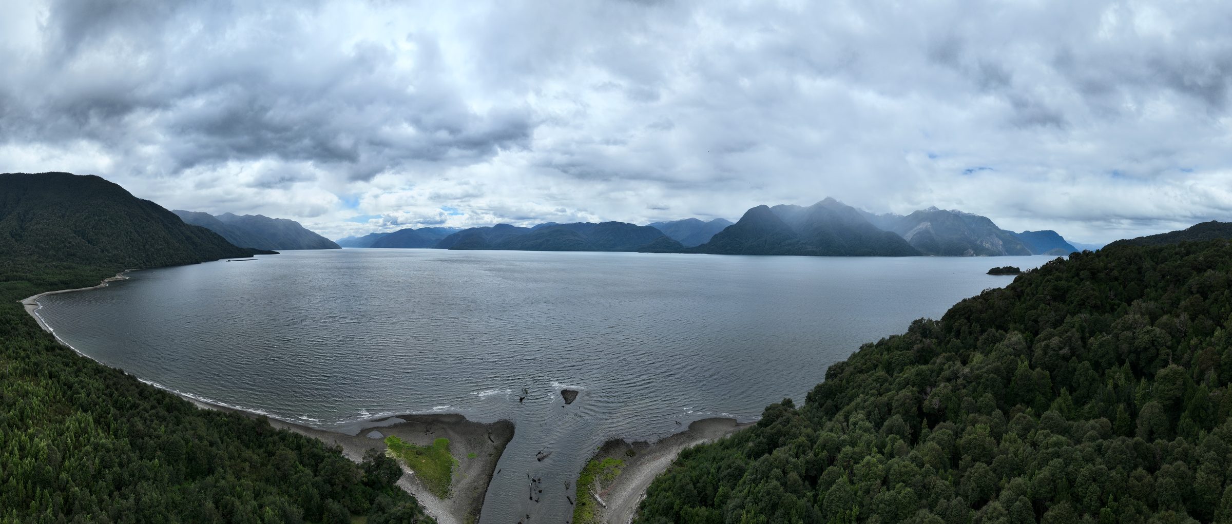
Punta Cola entered the fjord at a depth of 203 metres, built an underwater ramp 320 metres wide and 580 metres long, and scattered rock blocks up to 3.5 kilometres away across the floor of the fjord. The shore at the delta retreated by a hundred metres.
Sources disagree about the height of the wave and both figures are true: at the northern tip of Isla Mentirosa the run-up reached roughly fifty metres, but only a few metres arrived on the inhabited shores. Modelling published in 2025 gives over 30 metres at Mentirosa, about 7 metres a short way to the south and under 5 metres at most of the measured points. The wave took about ten minutes to reach Puerto Chacabuco.
Ten people died. The waves destroyed houses and small settlements along the fjord, swept away salmon farms and released millions of farmed fish, and both Puerto Chacabuco and Puerto Aysén lost their drinking water.
The floor of the fjord itself was deformed too, over an area of 7.6 km²: a strip covering 1.85 km² was stripped of one to ten metres of sediment, and pressure ridges bulged upward by as much as fifteen metres.
The scientific conclusion was unambiguous: the event created a new situation of seismic and landslide hazard on the shores of the fjord, in places that had previously been considered safe.
Where you can touch the geology: the hot springs
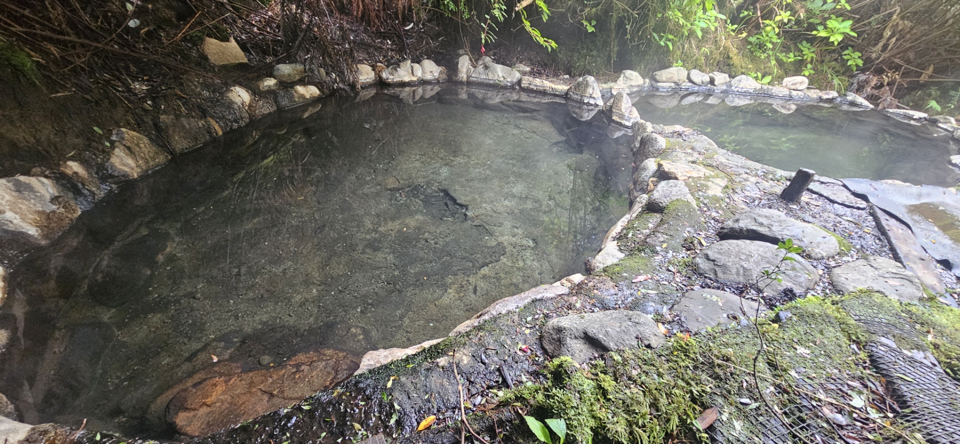
Termas Ensenada Pérez. Natural pools at 35 to 36 °C inside the Cinco Hermanas natural monument. The only way to get there is by boat from Puerto Chacabuco across the Aysén fjord, with a view of the glaciated summit of Macá. The geological point is that the springs are in Bahía Pérez, exactly where the Smithsonian records the youngest lava flow of the Macá volcano, emplaced between 1450 and 1670.
Termas de Puyuhuapi. Pools at 30 to 42 °C, sixteen kilometres south of the village of Puyuhuapi and 225 kilometres by road from Coyhaique. The water is rich in bicarbonates and contains chloride, sulphate, magnesium, chromium, zinc and selenium. The springs lie at the head of the Puyuhuapi fjord, on the same fissures that carry that field of very young scoria cones.
A study made between 2020 and 2022 by the Andean Geothermal Centre of Excellence at the University of Chile concluded that a geothermal cogeneration plant at Puyuhuapi is feasible: the reservoir is at 120 to 150 °C at depth and the proposed output is 0.3 to 1 MW. It would be the southernmost geothermal plant in the world, but for now it is a feasibility study and not a building site.
A note for anyone looking for Bahía Acantilada: it is not a hot spring but a beach opened on 11 January 2022 in the commune of Puerto Aysén, which the Chilean navy describes as the southernmost officially equipped beach in Chile.
How it is watched and how dangerous it is
The volcanoes are monitored by OVDAS, the observatory of the southern Andean volcanoes, founded in 1996 and based near Temuco. The national volcano monitoring network was created in 2009, after the eruption of Chaitén.
OVDAS monitors 45 active volcanoes in real time, from the Arica y Parinacota region down to the Aysén region. Aysén is therefore the southern limit of the Chilean volcano monitoring network.
The alert scale has four colours: green (calm), yellow (minor to moderate unrest), orange (heightened unrest or a small eruption) and red (imminent threat or an eruption in progress).
All five Aysén volcanoes were last verified at green. The most recent confirmed figure is Hudson at green on 12 August 2025, after more than forty weak tremors had been recorded, which the authorities described as normal. Check the current state directly with SERNAGEOMIN before you travel, because the levels change.
Hudson stands 13th out of 92 in the Chilean volcanic risk ranking, in the very high risk category, and it is often described as the most powerful volcano in Patagonia.
What of all this can be seen on the ground
The ash from 1991 is still in the ground. Fieldwork in 2020, 29 years after the eruption, found a tephra layer 20 to 103 millimetres thick at sites about 76 kilometres north of the volcano and 27 to 141 millimetres about 109 kilometres to the south. The authors point out, though, that the layer is present almost everywhere in lakes while on land it is missing in many places, so an exposure in a river bank is a find rather than something to be taken for granted.
The upper Ibáñez valley is the documented area in Chile where the ash of 1991 was thick enough to lead to permanent abandonment of farms.
The Huemules valley and Bahía Erasmo carry the traces of the lahar and the glacial flood of 1991: the flow reached 45 kilometres from the volcano and widened the river from eighty to a hundred and seventy metres.
The crossing of the Aysén fjord from Puerto Chacabuco, the usual route both to the hot springs and to the boats for Laguna San Rafael, passes the landslide scars of Punta Cola and Isla Mentirosa and gives a view of the Macá volcano.
An honest note: we have not verified any signposted viewpoints of Hudson. The volcano is about thirty kilometres from the Carretera Austral, under an ice cap, and we found no public mirador in any authoritative source.
Frequently asked questions
Is there an active volcano in the Aysén region?
Yes, five monitored ones: Hudson (1,905 m, last eruption 2011), Macá (2,960 m, 1560), Cay (2,090 m), Mentolat (1,603 m, 1710) and Melimoyu (2,400 m, around AD 200). All of them were last verified at the green alert level.
What happened in the eruption of the Hudson volcano in 1991?
The eruption began on 8 August 1991 and peaked from 12 to 15 August with a column roughly 18 kilometres high. It was a VEI 5 event with a volume of about 4 km³ of tephra. The ash covered more than 100,000 km² of Chile and Argentina, travelled as far as the Falkland Islands and killed an estimated several hundred thousand to a million head of livestock.
Was there a tsunami at Puerto Aysén?
Yes. On 21 April 2007 an Mw 6.2 earthquake directly in the fjord triggered 538 landslides. The Punta Cola rockslide, with a volume of roughly 21 million m³, fell into the fjord and raised a wave whose run-up reached about fifty metres at Isla Mentirosa, while a few metres arrived on the inhabited shores. Ten people died, and the wave took about ten minutes to reach Puerto Chacabuco.
Are the hot springs in Aysén of volcanic origin?
Yes. Termas de Puyuhuapi lie at the head of the Puyuhuapi fjord, on the same fissures as the field of very young scoria cones connected to the Liquiñe-Ofqui fault. Termas Ensenada Pérez in Bahía Pérez sit right at the end of the fifteen kilometre fissure of the Macá volcano.
Is travelling in Aysén dangerous because of the volcanoes?
The volcanoes are monitored continuously by the OVDAS observatory and the alert levels are public. The real risk to a visitor is lower than the risk from the weather and from remoteness, because in many parts of the region there is no road, no signal and no doctor within several hours. Do check the current alert level with SERNAGEOMIN before you travel.
Sources
- Smithsonian Global Volcanism Program: Cerro Hudson
- GVP Bulletin, August and September 1991: the Hudson eruption
- Frontiers in Earth Science (2024): the 1991 Hudson tephra
- Sepúlveda et al., Landslides (2010): landslides in the Aysén fjord
- Lastras et al., Eos (2013): deformation of the fjord floor
- Coasts / MDPI (2025): modelling of the 2007 wave
- Wilson et al., Natural Hazards (2011): the impact of ash on agriculture
- USGS Open-File Report 2016-1192: the velocity of the Nazca plate
- University of Chile: Puyuhuapi geothermal study (2022)
Where sources disagree, the range and the source are given. Figures are current as of August 2026.
Related
San Rafael Glacier: the day the glacier spoke →Carretera Austral: a guide →Aysén region guide: landscape, climate, hot springs →See the volcanoes and glaciers of Aysén with your own eyes - 12 days in January 2027.
About the expeditionWritten from Aysén
What didn't fit in the article
Every so often I send an email about what is happening in Aysén, new articles like this one, and chapters of Václav Nový's memoirs, which I translate from the Spanish. When places open on an expedition, I'll mention it in one line. Nothing else.
Two emails a month at most. One-click unsubscribe. Your address is never shared, privacy policy.
All articles
Patagonia from scratch · series
Series part 1 · The Aysén region: a province younger than Czechoslovakia24 Aug 2026Aysén in depth
Darwin in the Chonos Archipelago: what he wrote in his diary29 Sep 2026 Whales, orcas and dolphins in Aysén: what you will actually see15 Sep 2026 The Ring of Fire in Aysén: volcanoes, a fault and a fifty-metre waveyou are hereGuides
Aysén or Torres del Paine? A comparison for the undecided5 Oct 2026 Patagonia: Chile or Argentina? How to choose4 Sep 2026 7 min listen What a Trip to Patagonia Really Costs26 Aug 2026 8 min listen Carretera Austral: What Driving It Actually Takes21 Aug 2026 7 min listen When to Fly to Patagonia: Months, Light and Flights17 Aug 2026 5 min listen Patagonia Without the Crowds: Where to Go Instead7 Aug 2026 8 min listen Chile's Marble Caves: How to Get There29 Jul 2026 5 min listen Cerro Castillo: The Trek They Call the New Torres del Paine22 Jul 2026 7 min listenBefore you book
Patagonia Tour or Small Expedition?22 Aug 2026Expedition journal
San Rafael Glacier: The Day the Glacier Spoke5 Aug 2026 2 min listen